Skip to Main Content
_
Sensor Network
Maps & Radar
Severe Weather
News & Blogs
Mobile Apps
More
Search
close
gps_fixed
gps_fixed
Find Nearest Station
Manage Favorite Cities
Log In
Go Ad Free
account_box
Log in
Go Ad Free
settings
Settings
Sensor Network
Maps & Radar
Severe Weather
News & Blogs
Mobile Apps
Historical Weather
star
Current Weather for
Popular
Cities
San Francisco, CA
53
°
F
Partly Cloudy
Manhattan, NY
warning
56
°
F
Fair
Schiller Park, IL (60176)
warning
68
°
F
Mostly Cloudy
Boston, MA
49
°
F
Sunny
Houston, TX
74
°
F
Cloudy
St James's, England, United Kingdom
53
°
F
Partly Cloudy
Search
close
gps_fixed
gps_fixed
Find Nearest Station
Manage Favorite Cities
settings
--
Feels like
--
--
--
/
--
--
--
--
--
--
--
--
--
--
12AM
6AM
NOON
6PM
12AM
Apr 17
+0000
Apr 18
Full Forecast
Where Storms Could Pack Wind Damage, Tornado Threats
Here's where the next rounds of severe storms could flare up as we head into late week.
Where Storms Could Pack Wind Damage, Tornado Threats
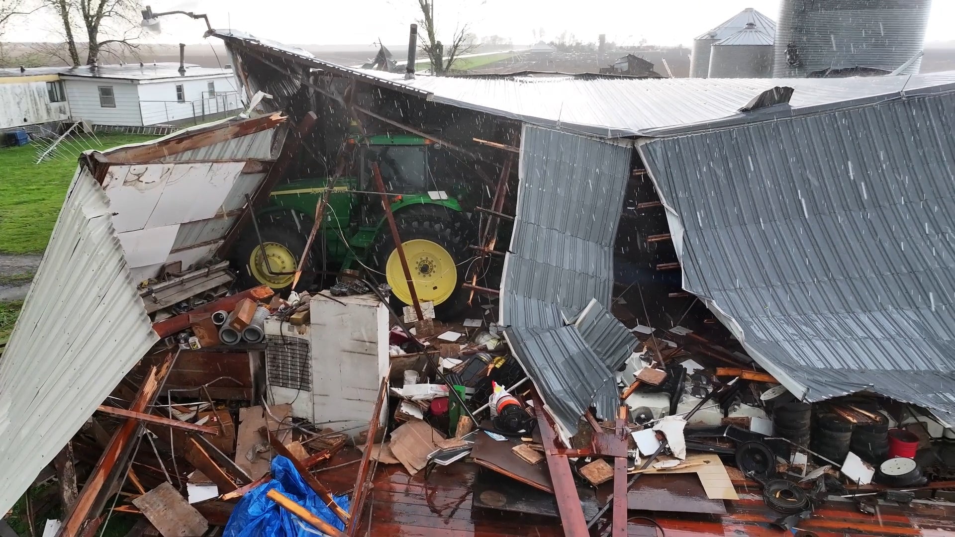
Tornado Rips Apart Homes, Farmsteads In Iowa
At least one tornado has been confirmed from storms that devastated parts of Southeast Iowa on Tuesday. See how the twister ripped apart homes and farmsteads, burying trucks and heavy equipment under debris.
Tornado Rips Apart Homes, Farmsteads In Iowa
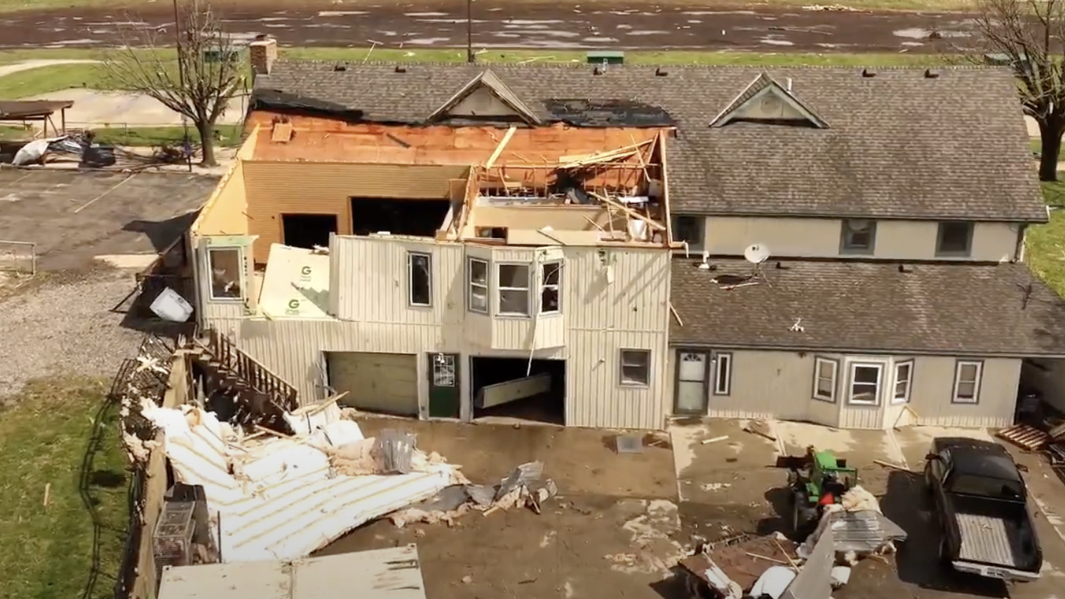
Roofs Ripped Off, At Least 2 Injured
Severe weather ripped across parts of the Midwest Tuesday.
Roofs Ripped Off, At Least 2 Injured
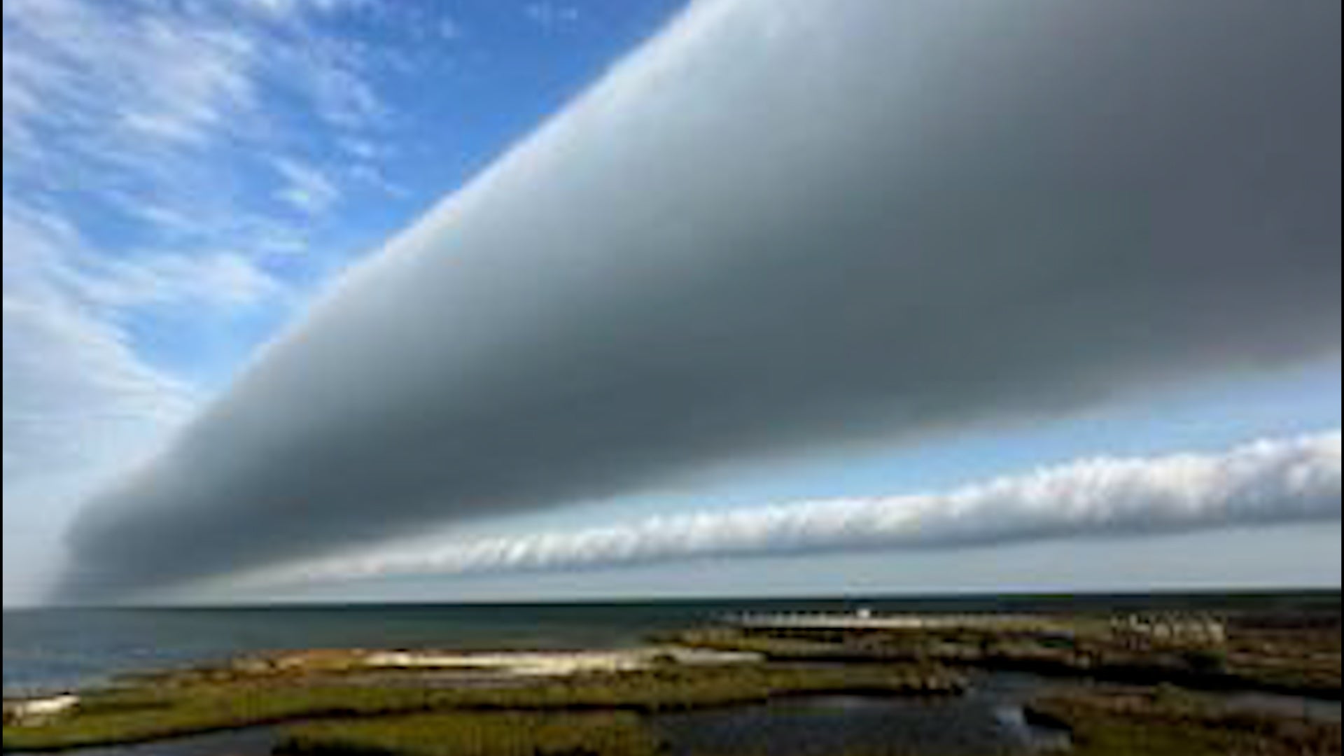
Watch Rare Wave Clouds Soar In North Carolina Skies
Wave clouds, also known as an undular bore, soared across the sky along North Carolina’s Outer Banks.
Watch Rare Wave Clouds Soar In North Carolina Skies
Intense Flooding Kills 18, Including Schoolchildren
At least 18 people, including 10 schoolchildren swept away in a vehicle, are dead after heavy rain caused flooding. More rain is expected this week.
Intense Flooding Kills 18, Including Schoolchildren
Please enable JavaScript to continue using this application.